Election Maps
GIS Maps
By Joseph M. Westenberg in redistricting project elections
February 8, 2022
After discovering the availability of some historical shapefiles from NHGIS and election data back to 2000 for many local elections from OpenElections, I wanted to assemble it for my personal research projects. While in the process of this I have started to map this data and make it available for readers to visualize patterns across time.
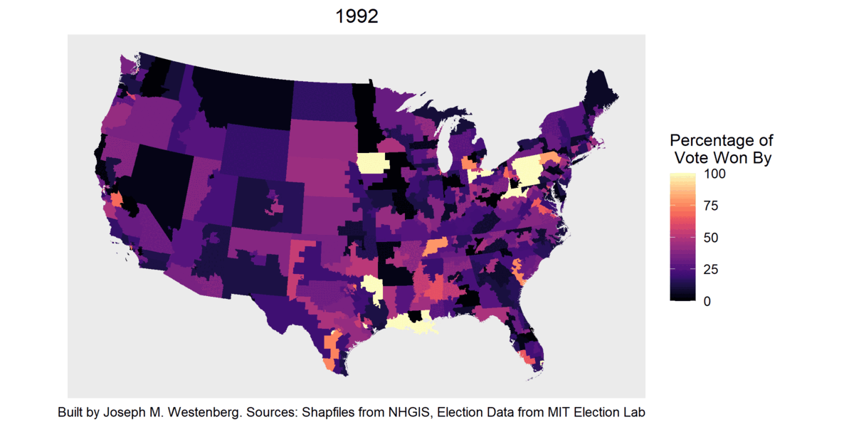
US Level Maps
For the following graphic the percentage of total vote the runner up received was subtracted from the percentage of vote that the victor received. Dark colors indicate competitive races, light colors are less competitive. For areas that are almost white/cream color, this probably indicates this election was uncontested. Election data comes from MIT Election Lab for US House Elections. Shapefiles from NHGIS.
Availability and Links to Individual Images
| Year | House Map |
|---|---|
| 1992 | X |
| 1994 | X |
| 1996 | X |
| 1998 | X |
| 2000 | X |
| 2002 | X |
| 2004 | X |
| 2006 | X |
| 2008 | X |
| 2010 | X |
| 2012 | X |
| 2014 | X |
| 2016 | X |
| 2018 | X |
| 2020 | X |
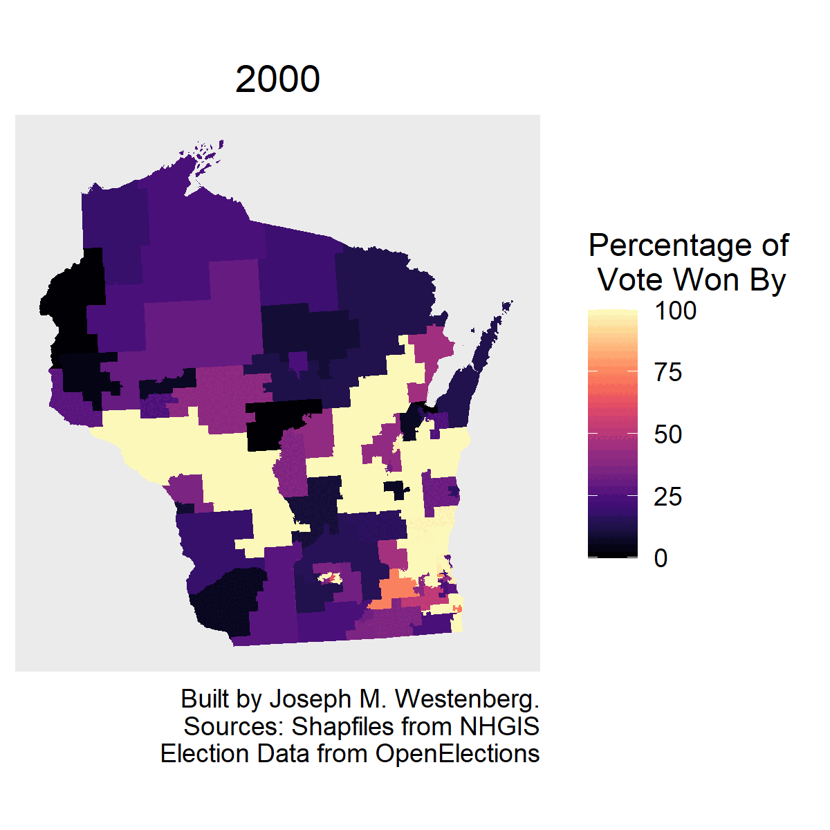
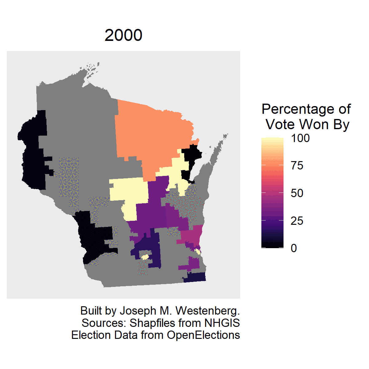
State Level Maps
Percentage of Vote Won By
For the following graphic the percentage of total vote the runner up received was subtracted from the percentage of vote that the victor received. Dark colors indicate competitive races, light colors are less competitive. For areas that are almost white/cream color, this probably indicates this election was uncontested. Election data comes from OpenElections. Shapefiles from NHGIS.
| Off Presidential Years | Presidential Years |
|---|---|
 |
 |
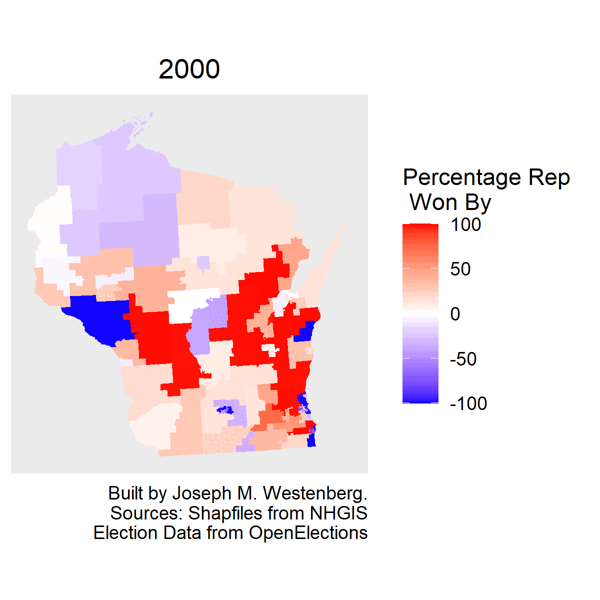
Partisan Skew
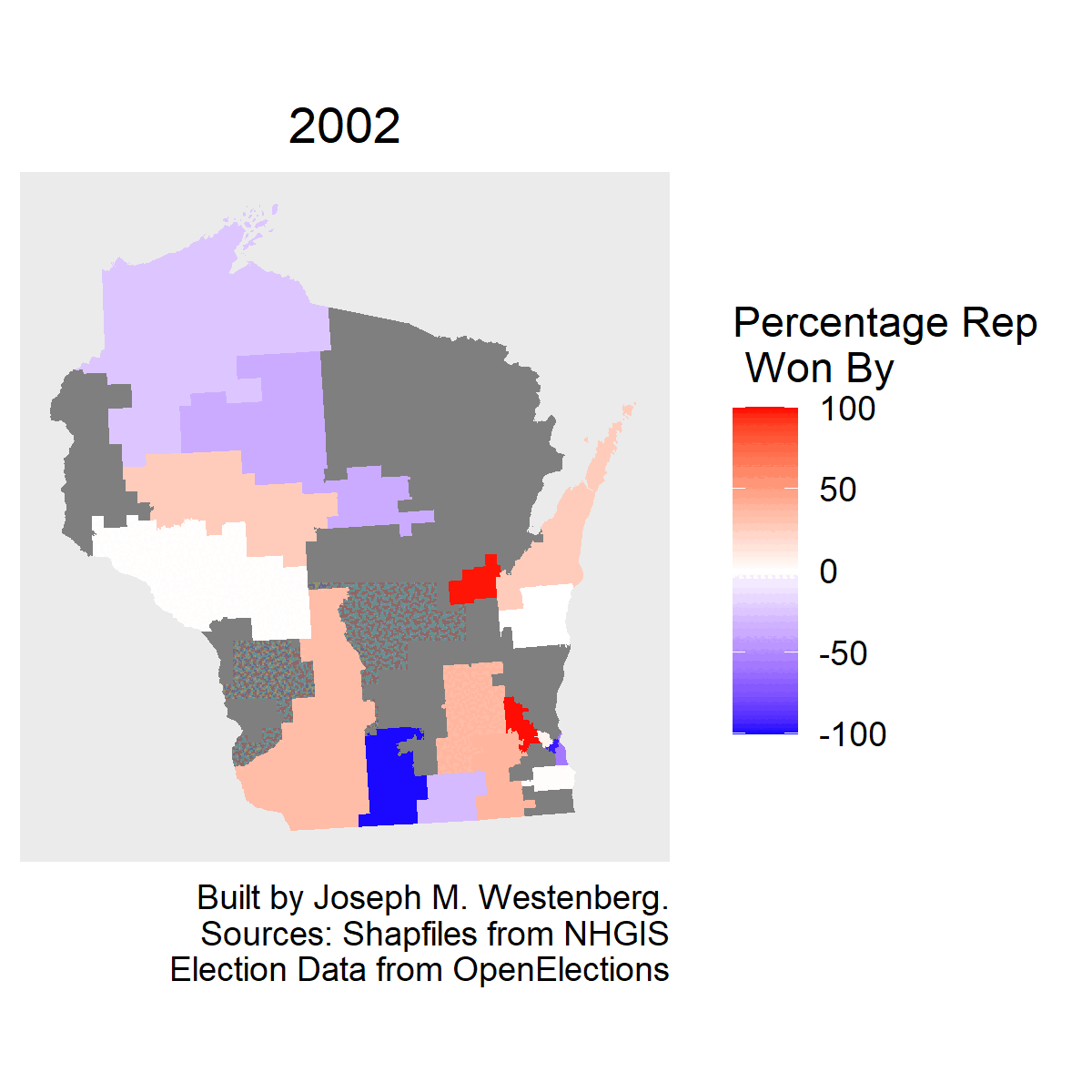
I take the above defined measure and assign negative value if it is not a Republican who won. In this case, dark red means the race went highly in favor of a Republican, dark blue indicates that it went highly in favor of a non-Republican (Democrat in most cases). White or light colors indicate competitive races. Election data comes from OpenElections. Shapefiles from NHGIS.
| Off Presidential Years | Presidential Years |
|---|---|
 |
 |
Availability and Links to Individual Images
Lower Legislative Body
| State | 2000 | 2002 | 2004 | 2006 | 2008 | 2010 | 2012 | 2014 | 2016 | 2018 | 2020 |
|---|---|---|---|---|---|---|---|---|---|---|---|
| IA | X | X | X | X | X | X | X | ||||
| IL | X | X | X | X | X | X | |||||
| IN | X | X | X | X | X | X | X | ||||
| MN | X | X | X | X | X | ||||||
| WI | X | X | X | X | X | X | X | X | X | X | |
| ALL | X | X | X | X | X | X | X | X | X | X | X |
Lower Legislative Body - Partisan Skew
| State | 2000 | 2002 | 2004 | 2006 | 2008 | 2010 | 2012 | 2014 | 2016 | 2018 | 2020 |
|---|---|---|---|---|---|---|---|---|---|---|---|
| IA | X | X | X | X | X | X | X | ||||
| IL | X | X | X | X | X | X | |||||
| IN | X | X | X | X | X | X | X | ||||
| MN | X | X | X | X | X | ||||||
| WI | X | X | X | X | X | X | X | X | X | X | |
| ALL | X | X | X | X | X | X | X | X | X | X | X |
Upper Legislative Body
| State | 2000 | 2002 | 2004 | 2006 | 2008 | 2010 | 2012 | 2014 | 2016 | 2018 | 2020 |
|---|---|---|---|---|---|---|---|---|---|---|---|
| IA | X | X | X | X | X | X | X | ||||
| IL | X | X | X | X | X | X | |||||
| IN | X | X | X | X | X | X | X | ||||
| MN | X | X | X | X | |||||||
| WI | X | X | X | X | X | X | X | X | X | X |
Upper Legislative Body - Partisan Skew
| State | 2000 | 2002 | 2004 | 2006 | 2008 | 2010 | 2012 | 2014 | 2016 | 2018 | 2020 |
|---|---|---|---|---|---|---|---|---|---|---|---|
| IA | X | X | X | X | X | X | X | ||||
| IL | X | X | X | X | X | X | |||||
| IN | X | X | X | X | X | X | X | ||||
| MN | X | X | X | X | |||||||
| WI | X | X | X | X | X | X | X | X | X | X |
Going forward I will try to make more and more maps available. To start I am just starting with states I have personal interest in. If you are however interested in seeing a particular state’s results, please email me at jwesten@iu.edu and let me know.
- Posted on:
- February 8, 2022
- Length:
- 3 minute read, 599 words
- Categories:
- redistricting project elections
- Tags:
- redistricting project elections
- See Also: